For Architects

Capture the existing, so you can design the future.

TruePoint Spatial uses LiDAR scanning to capture existing residential and commercial buildings and sites in 3D, giving your team a detailed record to reference throughout design. We work across a range of properties, from homes and offices to restaurants, retail spaces, schools, and municipal buildings. Work directly from the point cloud, or have us turn the capture into 2D drawings or a Revit model. Bring the project into the tools your team already uses, with a practical starting point and reliable existing-conditions information to support design from start to finish.

  • Scan-to-BIM
  • Coordinated spatial reference
  • Residential + Commercial
  • Point cloud, Drawings, or Revit
  • Return to the scan, not the site
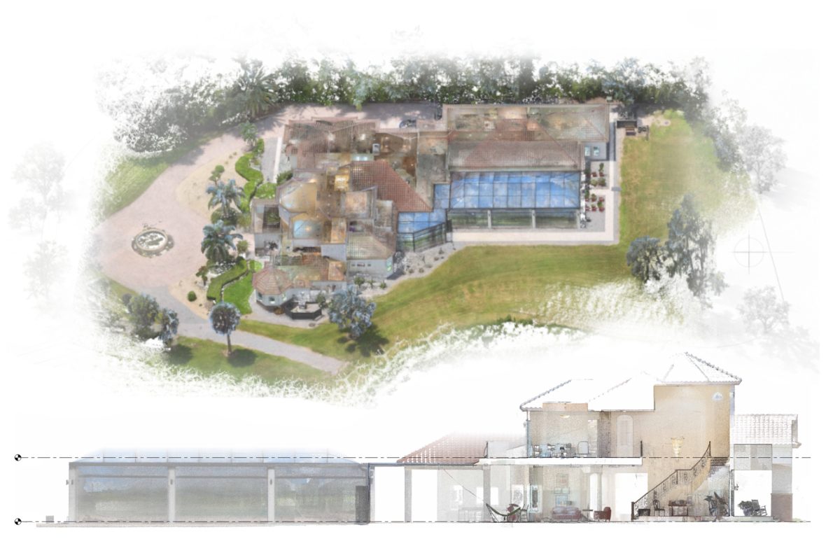
Colorized point-cloud views of captured building and site conditions.

3D Reality Capture

Capture

We scan the home, building, or site to create a detailed 3D record of the property as it exists today. The result is a measurable point cloud and visual record that lets you revisit the property, see captured details, and take measurements after the scan is complete.

  • • Registered point cloud E57 file
  • • Autodesk-ready RCP/RCS package
  • • Scan visualization sheets
  • • Packages starting at $750
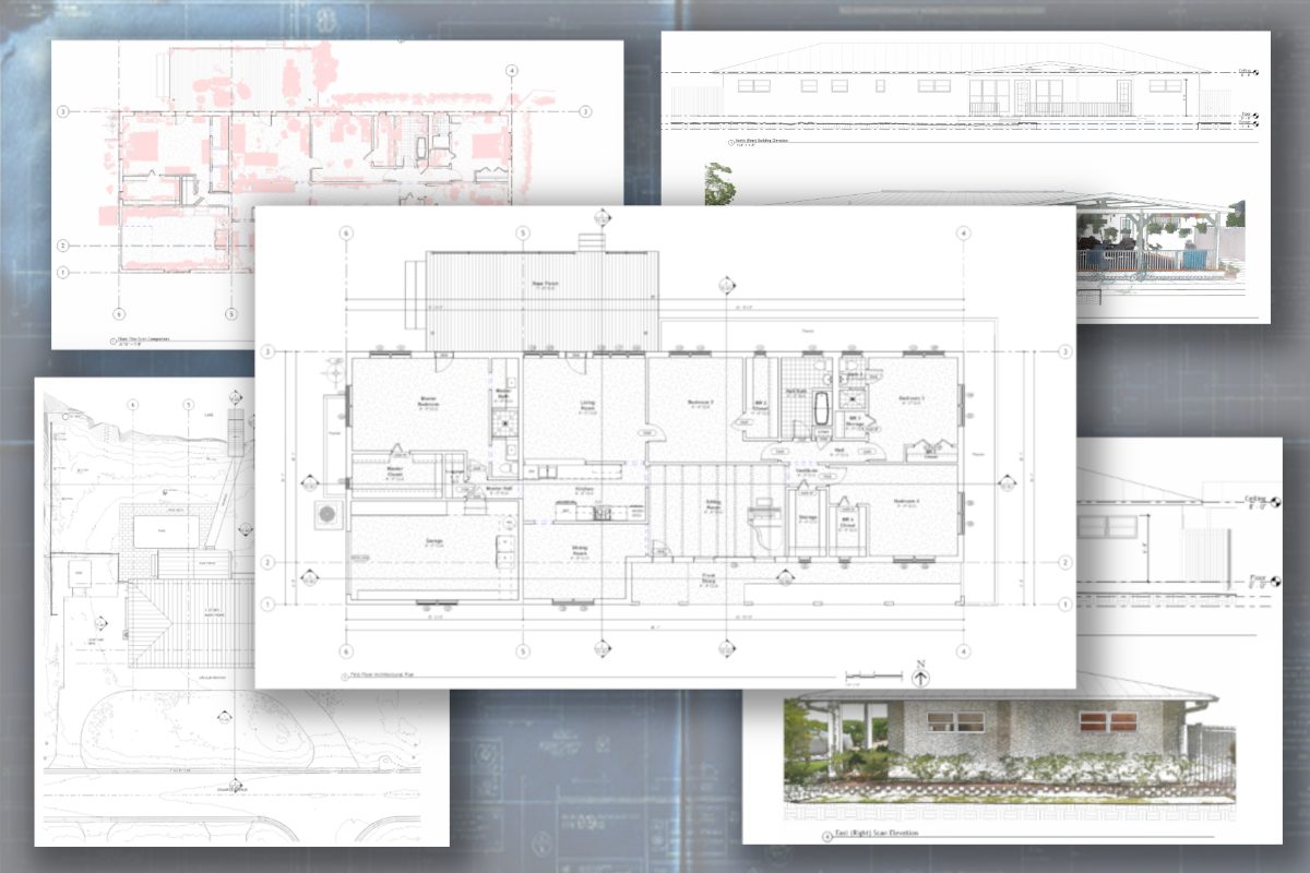
Existing-condition floor plan, elevation, and section drawing sheets.

Design-Ready 2D

Drawings

Build on the 3D Capture with detailed 2D drawings. Floor plans, elevations, and sections are created directly from the scan, giving your project a reliable starting point for design and planning. Start design with the existing conditions already drafted.

  • • Everything in Capture
  • • Plans, elevations, and sections
  • • PDF and DWG files
  • • Packages starting at $1,500
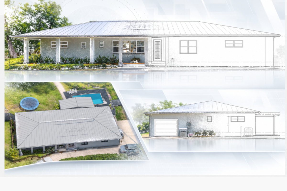
Building exterior photographs paired with existing-condition elevation views.

Revit Existing Conditions

Model

Build on Capture and Drawings with a Revit model of the project. Created from the 3D scan, the model gives the design team a ready-to-use digital starting point for renovation, addition, and design work. Start design with the existing property already modeled.

  • • Everything in Capture
  • • Everything in Drawings
  • • Revit model RVT file
  • • Packages starting at $2,000

Design Context

LiDAR gives a better start for every design project.

Whether you’re working with a residential or commercial property, existing conditions often involve layers of geometry and spatial relationships that are easier to understand in three dimensions. LiDAR captures the building’s geometry, spatial relationships, and unique details, giving your team a clearer understanding of the project and a stronger foundation for the next phase of design.

01

Understand the Vertical Relationships

LiDAR captures floors, ceilings, structure, stairs, and grade together, making the vertical relationships between building elements much easier to understand and coordinate.

02

Capture the Tie-In Conditions

For additions and renovations, understand the places where new work will meet existing construction. LiDAR gives your team measurable context around walls, openings, elevations, and adjacent conditions.

03

Document the Irregular Geometry

Existing buildings are rarely perfectly square, level, or plumb. LiDAR captures angled walls, slopes, stairs, and other irregular geometry that can be difficult to document conventionally.

04

Connect the Building + Site Together

Capture the building and surrounding site together so your team can clearly understand how floor elevations, circulation, grade, hardscape, retaining walls, and other site features relate to one another.

Planning a remodel, tenant improvement, addition, or upcoming project?

Take existing-conditions off your to-do list.

Tell us a little about the property and what your team is working on. We will help determine the capture scope and deliverable level that fit the project.